A Land Survey establishes the boundaries of a parcel of land allowing positive identification of land features and prevents Boundary Line Disputes.
Boundary Line Disputes along with Easement Problems and Water Rights are the most litigated problems involving the purchase of rural land.
What is a Land Survey and why do I need one?
A survey can determine the boundaries of the land, let you know what features are on the land, can tell you if a neighbor is encroaching on the land and in some instances can determine easements across the land.
The following article will discuss surveys, why a survey is important, the different types of surveys and what to do if a survey shows a problem with encroachment by a neighbor.
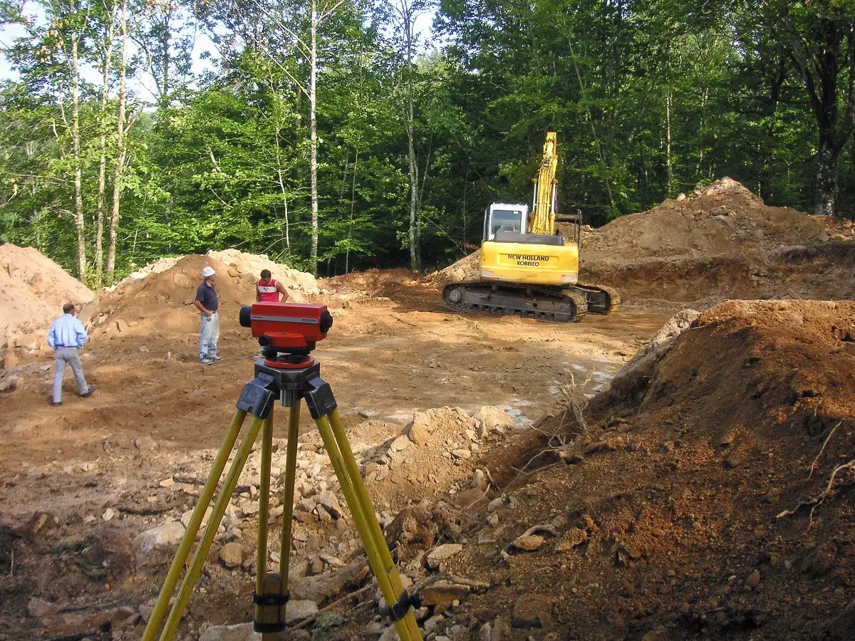
What Is A Survey?
A survey is a precise system of measurements that lets you know where the boundaries of a piece of property are.
A survey may also be needed to place boundary markers also called monuments.
Because a survey has a cost attached to it, many times the sale of rural property is made without a survey being done.
Several years ago we moved to a piece of property that had recently been surveyed and all the boundary lines were marked with yellow tape markers.
A few years later the neighbor behind us had a portion of his property logged.
Several of the boundary markers were attached to tree limbs of trees that were growing on his land.
As a result, many of the trees with boundary markers were cut down in the logging.
Now only 2 boundary markers are left on that entire side of the property.
The property behind us has been sold twice since the logging was done.
Neither time was it surveyed and the purchasers were told by the Realtor, “I don’t know where the boundary lines are.”
Fortunately both sets of new neighbors came and asked me where the boundary line was and I could show them the 2 remaining markers and they were satisfied.
A Brief History Of Surveying
Surveying is an ancient art that was first developed in Egypt between 5000 and 7000 years ago depending upon the sources you read.
Many people are surprised to find that the Bible makes reference to marking of boundaries.
Dueteronomy 19:14;”Thou shalt not remove thy neighbors landmark, which they of old time hath set in thine inheritance,…”
Dueteronomy 27:17; “Cursed be he that removeth his neighbor’s landmark. And all the people shall say, Amen.”
Proverbs 22:28; “Remove not the ancient landmark, which thy fathers have set.”
Proverbs 23:10; “Remove not the old landmark; and enter not into the fields of the fatherless.”
Job 24:2; “Some remove the landmarks; they violently take away flocks, and feed thereof.”
Surveying in the U.S. began in 1784.
The U.S. Surveyor General began to survey public lands using what is commonly known as the rectangular survey system.
Prior to the establishment of the United States of America after the Revolutionary War, surveys were done on the land included in the British colonies.
Many of you probably remember that one of the early surveyors was George Washington.
How Can A Survey Let You Know What Features Are On The Land?
When rural property is up for sale it is customary for the advertisement to say how many acres there is, how much land is pasture, timber, cultivated, whether there is a pond, creek, spring, road, barn, other outbuildings and a house on that property.
All across the U.S. as much as 1/3 of all rural lands sold have some of the features advertised off of the land entirely or a portion of a building or a fence on a neighbor’s property.
The only way to know for sure what features are included on a piece of property is to have that property surveyed.
A Survey Was Done In The Past, Isn’t That Sufficient?
At first glance it would seem like land once surveyed would not need any later surveying done. However, that is not the case.
First of all if the surveyor is no longer alive there is no one to question about the survey.
If a survey is challenged in court by a neighbor, you need the person who surveyed it to be able to speak up in defense of the survey.
A surveyor will typically defend a survey that he did for 10 years or maybe longer.
In the final analysis, the length of time a surveyor will defend a survey is determined by how long his liability for the survey lasts.
That length of time is usually determined by State Law.
Are There Different Types Of Surveys?
Yes, there are several different types of surveys.
The surveys most commonly used when purchasing rural or Homestead property are:
- ALTA, (American Land Title Association), Survey is a survey that may be required by a Title Company or Mortgage Lender. An ALTA Survey shows property lines, the location of improvements to the land, any legal and utility easements on the land and features such as creeks and cliffs that affect the property.
- Boundary Survey shows actual property lines and corners of the land. Usually done to resolve boundary disputes or to show where a fence should go.
- Floodplain Survey may need to be done on low lying land near a large creek or river. Also called an Elevation Survey, it shows the elevation of land and if it is in a floodplain. This type of survey may be required to get Hazard Insurance on property.
- Lot Split Survey is done when a parcel of land is divided into 2 or more separate parcels. This survey provides the Legal Description of each parcel of land and shows the new boundary lines of each parcel.
How Long Does A Land Survey Take?
Surveying a small parcel of land such as 2 or 3 acres can be done in a day.
Larger parcels of land can take longer to survey.
If the land has dense undergrowth it will take longer to survey it.
Another factor in how long a survey takes is how busy the surveyor is.
Like most businessmen, a surveyor takes jobs in the order they were requested unless the client is willing to pay extra for a Priority Survey.
From the time a survey is ordered until it is completed can be two weeks or more depending on the time of year and how busy the surveyor is.
For a survey to be complete, the surveyor may need to do some research in the County Deeds Office to assure that there are not competing claims on a piece of property.
When a surveyor certifies a survey he is placing his reputation on the line saying this survey is an accurate representation of the land surveyed.
Is A Survey Legally Binding?
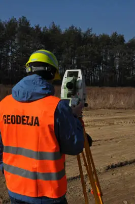
A land survey is done by either Civil Engineers or Licensed Land Surveyors.
They are highly trained and skilled professionals whose work product, the finished survey, is legally binding.
Because it is legally binding it can be relied on by the bank, mortgage company and County Officials such as the County Tax Assessor.
It can also be used for evidence in a property line dispute in court.
Because it is legally binding the surveyor will take great pains to be sure it is both factual and accurate.
How Much Does A Survey Cost?
The price depends on several different factors:
- The locality, a survey is more expensive in California than in Montana.
- The reputation and experience of the surveyor
- The size of the parcel of land to be surveyed
- The ease of getting to the land to be surveyed
- The type of terrain, it is easier to survey flat land than mountainous land
- The ease of locating boundary markers or monuments needed to do the survey
- The time actually involved in doing the survey, the necessary research and drawing up the final survey documents
In 1987 we were in the process of getting a take out loan on a piece of property where we had built a house.
The take out loan would pay off the construction loan and become the Mortgage on the house and land.
We had a 30 day loan approval at a good rate of interest but if the loan could not close in that 30 day period of time the interest rate would readjust higher.
All the necessary paper work was completed and Closing was scheduled for day 21 of the 30 day loan commitment.
When the Closing day came, it was discovered that the survey on the land had an error of closure.
The boundary lines did not come together on one side of the property.
A Priority Survey was ordered and we were able to get a new survey done and complete Closing before the 30 day period of time for the Loan Commitment at the lower rate of interest expired.
Because it was a Priority Survey, we paid extra for that service.
That survey of less than 2 acres of land cost us $560.00.
The Surveyor had to put off other jobs, do the survey, related research, draw up the survey map and document and certify his work.
Then a new deed had to be drawn up with the new property description from the survey.
We were living in Tennessee at the time.
Getting the new survey done and paying for it on a priority basis cost us less than the additional interest we would pay in one year’s time if the loan’s interest rate had readjusted to the higher level.
A Survey Team usually includes at least 2 people and the hourly charge is in the range of $150/hour or more depending upon the location.
If no survey has been done in the area for several years and the survey markers or other starting points are a long distance away, the survey may cost several thousand dollars.
Remember that a survey involves a lot more time and effort than just measuring out the land and drawing a survey map to scale.
Does A Cash Buyer Need A Survey?
Many lenders require a survey as part of the process of approving a loan.
A Cash Buyer does not need a lender and there is no legal requirement for a survey if you are not borrowing money.
That said, why would you not want a survey on land you are paying cash for?
Without a current survey you will not know exactly where the boundary lines are.
So you will not know if all the features of the land are within the boundary lines.
What are you going to do if a neighbor says that a fence or some feature of the property is actually on his land and not on your land?
Now you are in a boundary line dispute and will need a survey to settle the question!
If you are paying out a lot of cash for a piece of property, one way to insure that you are getting everything you are paying for it to get a current survey with the purchase.
A survey is a form of protecting your purchase.
I do not recommend anyone purchasing property without a current survey included in the deal.
What To Look For In A Land Survey
- A Boundary Survey should include property boundaries and the surveyor should have verified the descriptions of all adjacent properties. This insures that property lines are exactly the same on all related documents.
- An ALTA Survey should have boundaries, location of buildings and other improvements, identify any easements and minimal set backs from the property line.
- A Floodplain Survey should show whether the home is in a flood plain. If it is in a floodplain there should be an Elevation Certificate with the home’s floor elevation and the lowest and highest ground elevations near the home.
- A Lot Split Survey should show the boundary lines, the minimum lot size in that area for building a dwelling and any property set backs that are applicable.
All surveys should have a property description that should go on the deed to the property.
Do Surveys Have An Expiration Date?
Surveys do not expire.
However, if the surveyor who made the survey is no longer working or has died, the survey is mostly an historical document.
There is no one to vouch for its reliability.
To be useful in a boundary line dispute or for obtaining a mortgage, the survey needs to be current.
The definition of what is current is not always the same everywhere.
Some Mortgage companies may require a new survey done before they will consider loaning any money on a piece of property.
How Do You Get A Survey Of Your Property?
In some limited instances there may be a survey of the property in the County Deeds Office or County Tax Assessor’s Office.
This is not very common with rural and Homestead Land.
If you are buying land, perhaps the seller has a survey.
If the survey is less than 10 years old, the surveyor is still willing to defend the survey and the Mortgage Company does not require a new survey, you are probably OK using that survey.
In the majority of instances it will be necessary to have the property surveyed to get a current survey that is certified and the surveyor is willing to defend if a problem arises.
Who Should Pay For The Survey, Buyer Or Seller?
In the typical Real Estate Sales situation the Seller is representing that the property is a certain size and that there are no property set back violations.
The Seller is also representing that certain features are located on the property and that there are no problems with the boundary lines such as a property line dispute.
The only way to prove that the Seller’s representations are accurate is to have a current, usually defined as less than 10 years old, survey of the property.
It should be the Seller’s responsibility to prove his representations by giving the Buyer a current survey showing that everything represented as on the property is in fact on the property.
It is the rare Real Estate Broker or Agent who tells the Seller to have a current survey of the property to give the Buyer.
In many rural areas of the country there is never a mention made about a survey much less there being a current one in existence.
It is a good idea to make it a provision of the Sale of the property that the Seller provides the Buyer with a current survey that meets the needs of any Mortgage Company or Bank requirements prior to Closing of the Sale.
If the Seller does not comply with this provision, the Buyer may cancel the sale and get back any earnest money and other funds expended and the Seller keeps the land.
A Seller is counseled on how to price his property so that he can come down in price and still make a profit.
So having to pay for a survey will not cause the Seller to lose any money.
If the Seller will not agree to this, you can see if he will split the cost 50/50 with you.
If the Seller won’t do a 50/50 split and you want that parcel of land, I’d reduce the offering price enough that I knew I could cover the cost of a survey.
If you purchase land that has a current survey you will be in a better position to sell it if needed in the future.
Land that has a current survey is worth more than land that does not have a current survey.
If a Seller has a survey done before placing the property on the market he is in a position to show that there are no boundary line disputes with neighbors and to prove that everything advertised is on the land.
How To Use A Land Survey When Purchasing Land
Be sure to check for the following:
- Was the surveyor a Licensed Surveyor or a Registered Civil Engineer?
- Was the survey recorded in the County Deeds Office as an Official Survey of the land?
- Using the survey, can you positively locate the boundary lines on the ground?
- Did the surveyor place permanent corner markers in the ground?
- Have the boundary lines been flagged?
You want at least permanent markers placed at all corners of the property.
If the property shape is not a square or a rectangle there can be more than 4 markers to locate each place the property line changes directions.
Can a friend stand by one corner marker and see you standing by the next corner marker?
If so you can get a good idea of where the boundary lines are.
If not, then the boundary lines should be flagged.
The 2 most common methods of flagging boundary lines are:
- Plastic ribbons will be tied on trees, tree limbs, bushes or spiked to the ground at regular intervals along the boundary
- Trees could be blazed, have a notch cut out of them, at intervals along the boundary lines. This creates a permanent marker. Sometimes the blazes are spray painted a color such as red, orange or yellow
If there is an important feature of the property such as a building, spring, creek or road that appears to be close to a boundary line, you will want that boundary line flagged or blazed before you purchase the land.
Sometimes a Buyer is given a map of the property instead of a survey.
Many times when the property is 20 or more acres, the map will be drawn to a scale of 1″ equals 500 or 1000 feet.
When this is the case, the width of the boundary line on the map can equal enough feet that a spring or stream may be on or off the property.
Don’t ever accept a map of the property instead of a current survey.
Always insist on a current survey showing the location of the spring, stream or any other features claimed to be on the land.
Other Benefits Of Getting A Survey
A lot of rural or homestead land is advertised as a given amount of land more or less.
An example is 40 acres more or less which may be stated as 40 acres + or -.
This is done because measurement techniques used by surveyors in the past may not have been as accurate as the measurement techniques are today.
If you insist on a current survey before purchasing the land and the survey of the parcel of land that is advertised as 40 acres + or – only shows 38.5 total acres, you may be able to negotiate a lesser price because the land is not 40 acres.
If the Seller does not want to pay for a survey and you like the land, don’t be afraid to ask the Realtor if they will pay for a survey to make the sale work.
Most Realtors would rather get half of a commission than no commission at all. I know of Realtors who paid for a survey and in another instance even reduced their commission by $500 to make a sale.
Are All Survey Descriptions The Same?
In the U.S. there are three different methods of survey descriptions.
They are:
- Descriptions by Reference to Sections, Townships and Ranges. This is also called the Rectangular Survey System that was put in use in 1784 by the U.S. Surveyor General. It is used in 29 States including Alabama, Alaska, Florida, Mississippi, and all States North of the Ohio River and West of the Mississippi River except Texas.
- Description by Metes and Bounds is what is used in the rest of the U.S. except the few instances listed below in number 3.
- The third method is the Map, Tract or Plat System. This is most commonly used to describe land that is referenced in another recorded instrument. This is usually encountered when purchasing land that is part of a large rural or second home subdivision or a suburban subdivision or a parcel split.
An Example Of Reference By Sections, Townships And Ranges
An example of this method would be:
The North Half of the Southeast Quarter of Section 12, Township 4 North, Range 2 West, Wind River Meridian.
The shortened form of this description could be: N1/2 of SE 1/4 Sec. 12, T 4N, R 2W Wind River Meridian.
This parcel of land would contain about 80 acres.
An Example Of Metes And Bounds
An example of this method would be:
From an iron post driven into the ground 15 feet due west of the junction of Bug Hollow and Deer Lodge Roads: Thence North 200 feet; thence East 200 feet to the West boundary of Carter White’s property described in Book 30 of Deeds, page 201 of the official records of Sumner County; thence 200 feet South along said line; thence West 200 feet to the point of beginning.
This parcel of land would contain slightly under 1 acre.
It contains 40,000 square feet of land and a square acre is 208.71 feet on a side and contains 43,560 square feet.
An Example Of The Map, Tract Or Plat System
An example of this method would be:
The real property in the County of Knox, State of Tennessee, described as Lot 28, Mountain View Subdivision (per map recorded August 1, 1999, at page 64 of Book 12 of Maps). County Recorders Office Knox County.
To learn the size of this lot you would have to go to the Knox County Recorders Office and look up Mountain View Subdivision in Book 12 page 64 and find the description of Lot 28.
Related Questions
Is an appraisal the same as a survey?
No. A surveyor measures your property’s size.
An appraiser compares it to other properties in the area that have sold recently and determines its current monetary value.
How close to my property line can I put a fence?
Each area of the country can be different.
Some areas allow a fence right on the property line and other areas say it should be 2, 4, 6 or 8 inches back from the property line.
You need to check with your County Building or Zoning Board.
Can I reuse an old survey of my land?
This is not recommended because there may be changes in the property bordering your land.
Another reason is the survey may be too old for the surveyor to be responsible for it.
However if the surveyor is still working, he may re-certify the survey after visiting the property to be sure that there are no changes in it or the neighboring property.
Re-certification usually costs less than a new survey.
If there have been changes to the property or to neighboring property, the surveyor may still give you a discount on the price of a new survey because he is keeping the properties business.